Skyrunning is a sport wherein you run at a minimum altitude of 2000 meters above sea level (MASL), usually on mountain trails. Air starts to get thin at this altitude, meaning a decrease in performance and possibly altitude sickness for us lowland dwellers. In the Philippines, skyrunning technically can only be done high up on the mountains because even our “City in the Sky†sits just around 1500m high.
The Kinabalu Climbathon started as training and qualification for Sabah rangers. Eventually it was opened to everybody as an international skyrace. Mount Kinabalu is the only Asian site included in the Sky Runners World Series Circuit and may have been proclaimed “The World’s Toughest Mountain Race†due to the sheer grade of the route combined with the steep cut-off time.

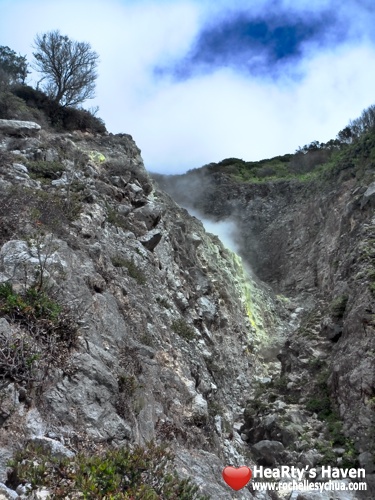
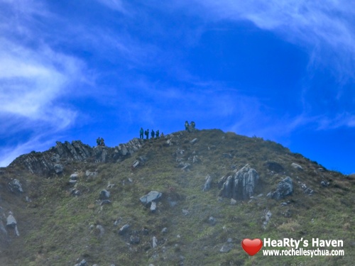
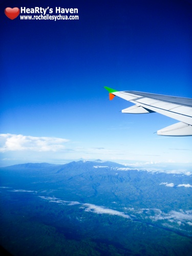
Mount Kinabalu Towering over the Heritage Park
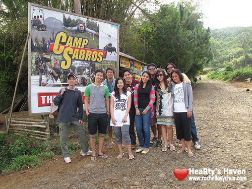
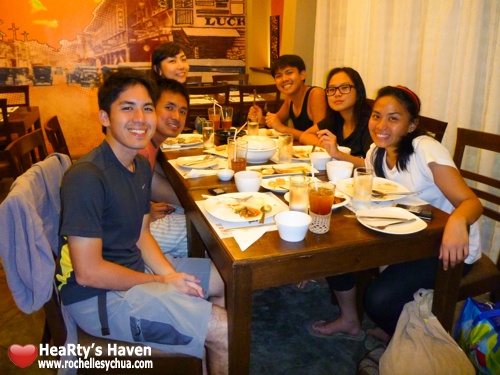
Early within the year, the adventurous advocates of the Apo climb brought to the table this “World’s Toughest Mountain Raceâ€. After a few days of reckless consideration, majority of us registered for the race and bought plane tickets that would have us on Kota Kinabalu on the afternoon of October 22 – a day before the race.
That was so wrong!
Below are some figures to chew on, which we did not consider before registering and buying plane tickets.
Altitude Comparison (c/o Carlos):
- Baguio City: 1524 MASL
- Climbathon, Starting Area: 1866 MASL
- Mount Pulag, Peak: 2922 MASL
- Mount Apo, Peak: 3148 MASL
- Mount Kinabalu, Peak: 4095 MASL
Temperature (c/o Carlos):
- At the base: 20-13 °C
- At the summit: 10-2 °C
Race Dates:
- Friday, October 22: Race registration and briefing for Women’s Open & Men’s Veteran (40 years and above)
- Saturday, October 23: Women’s Open & Men’s Veteran and briefing for Men’s Open
- Sunday, October 24: Men’s Open and awarding ceremonies
Cut-off time:
- Women Open and Men’s Veteran: 3:30 to summit and 3:00 to finish
- Men’s Open: 2:30 to summit and 2:00 to finish

Route map from the Climbathon website.
We were spooked! We are neither superiorly gifted physically, nor are we seasoned veterans with years of training in similar activity, and within that group I was the one with the slowest road race times. Thankfully, a race finisher assured us that it is still humanly possible to participate and not die. But he warned us to train hard if we wanted to reach the peak and finish within the cut-off time.
Registration
Pre-registration was easy and simple via the online form system. Conducive to impulse decisions such as ours, but without back-out problems. Fill-out, submit, you’re done! As of posting this article, the registration page is still up if you want to take a look. Participation is finalized upon on-site registration and payment on the days before the race. For the men and women open categories, the fee is 35 USD for international participants while it is 60 MYR for Malaysians. The veteran (40 years and above) category runners only have to pay 30 MYR. Those who did not register online will be waitlisted during the on-site with no guarantee of a slot, so pre-register online and save yourself some hassle.

Confirming our online registration.
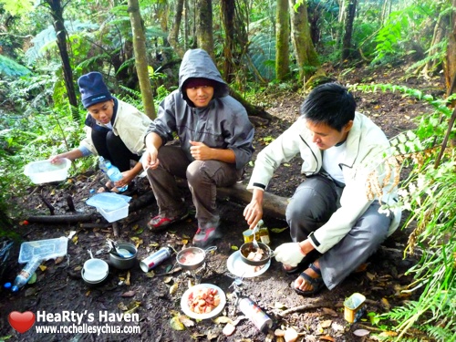
Registered participants are given a 1-month training pass for free entry into the heritage park and also as clearance for climbing the mountain. Practice climbers should still pay 7 MYR per climb though, for insurance. This minimal fee is a hundreds of MYR away from the cost of a regular climb as for safety reasons climbers are not allowed to go up without official guides. On top of that, unless climbers are fit enough for a day climb (crazy fit) they will have to book for a night’s stay at Laban Rata, a lodge way up the mountain. Staying there is expensive (300+++ MYR/head) but it pays for hot showers, cozy heated rooms, hot meals, and other peace-of-mind matters we tend to take for granted in our daily lives. Also it’s required if you want to see daybreak at the summit (though there are cheaper lodges available for 300+ MYR/head).

The training pass. (Photo by Jules P)
It is important to note that Climbathon practice climbers hold great responsibility for their own safety. They are expected to have an understanding of the difficulty of the climb and should be able to turn back when they should turn back. This basic rule is not written but it should apply for personal safety: be back at the Timpohon gate by 5 PM at the latest. Although the very kind and accommodating park authorities will not abandon people to the mountain, it is no excuse for us to be reckless or pasaway.
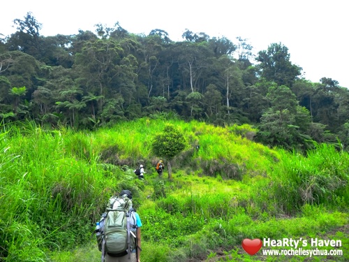
The Practice Climb
“Athletes do not train for a marathon by running a marathon distance, do they?†Wisdom from Mon M, an Herbalife athlete who finished the race last year and is in good shape to finish it this year (and he did, with better time). But for me, I was dead certain that I will not make it to the peak on the race itself, so of course I will climb till the peak now while I could! Haha. And so this practice climb was the highlight of my trip, instead of the race itself.
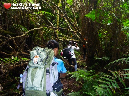
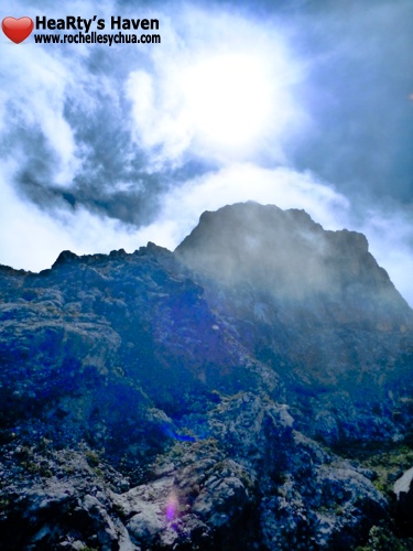
The highest peak is the turnaround point of the race and is ironically named “Low’s peakâ€. It was named after Hugh Low, a British colonial who made the first recorded climbs from 1851. He tried thrice without reaching the peak that now bears his name (Wikipedia). Today, reaching Low’s peak is simple – there is no need for special mountaineering skills or gear. The area is peaceful – there are no insurgent rebels using the mountain as a training ground. The rainforest is rich and abundant yet aside from squirrels there are no dangerous animals to watch out for. Trail running experience is helpful for foot efficiency and avoiding injury especially during fast descents, and basic rope skills are useful at the final 2.5Km. There are roofed stops with toilets along the route, plus there’s a well-equipped lodge with a restaurant and store at Laban Rata (around Km 6). Mobile phone signal is strong all around the mountain and in case of emergencies help should not be too far away.
In short it’s just you versus the monster of a mountain that is Kinabalu.
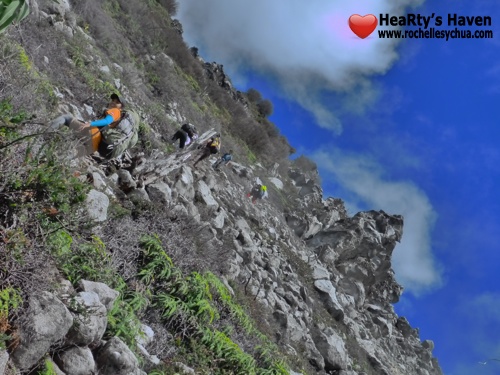
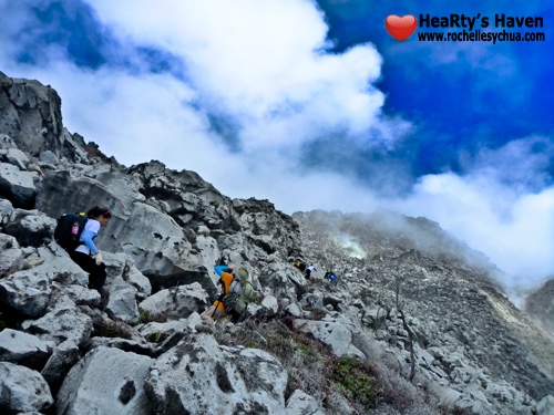
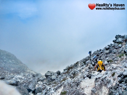
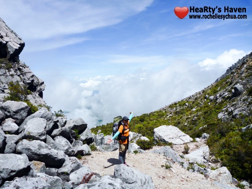
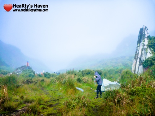
The cement roads end at Timpohon gate. The trail is mostly rocky and stair-like all the way, and there are distance markers every 500 meters. Immediately outside the gate you are greeted with steps going down. Savor the downhill feeling while you can, for it is up, up and up from there. The climb never seems to end, as every turn you make reveals more steps up. As you gain altitude, the air thins out and gets colder, the rich rainforest give way to shrubs and thinner trees, and the thick forest canopy opens up to expose pristine skies. Higher up, barely any plants survive in the thin air and bare granite. The last 2.5Km is of sloping, naked granite with the trail to Low’s peak marked by a white rope.

A short, soft-trail descent outside Timpohon gate.

Bone-bustingly hard concrete steps.

Wooden steps are built over tricky trails.

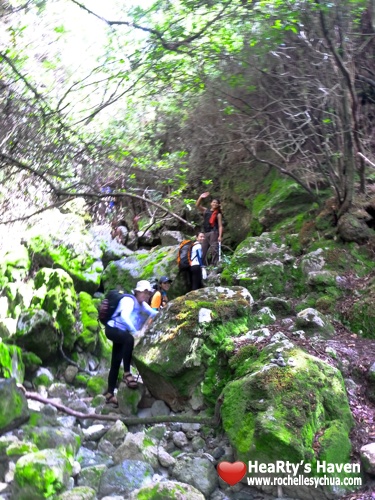
Boulders!

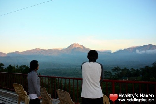
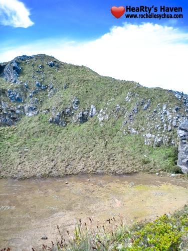
Nice views mid-climb, which cannot be savored while racing.

Chiseled rock steps.

Laban Rata . A well-equipped hotel and restaurant above the clouds.

At the start of the rope section. The camera is level here.

“Tito Willy†conquered his fear of heights smiling all the way.

From here, the peak was still 2 hours away.

Beautiful slope.

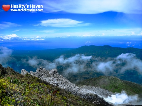
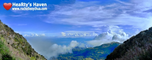
Almost there! A great view toward the South Peak.

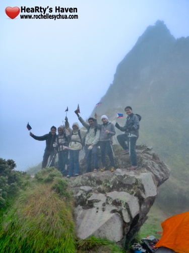
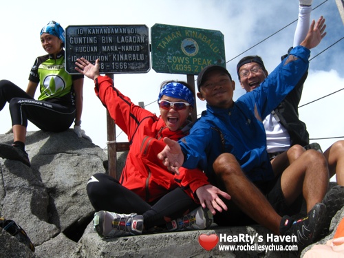
Summit! 😀
Summit! The group’s time to summit was longer than the cut-off for the race. Specifically, the cut-off for the women’s open/men’s veteran category. More accurately, the ascent and descent cut-off times combined. Still, the view on top was spectacular and it just wipes away the exhaustion. No photos could do justice to these works of God.
We took our time to dance at the tiny summit, but there was not enough for a second dance. We have far exceeded our deadline and should rush downwards to safely beat the dark. Successful on that, but try as I might, it’s not good enough for the men’s veteran descent cut-off time of 3 hours.

Going down from the summit. (Photo by Nina D)

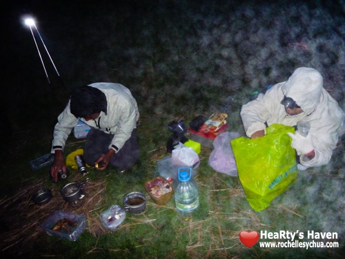
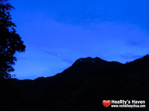
The forest grows eerie as the fog descends on the mountain.
The strenuous climb and repeated pounding took its toll on my body, and I did not get to replenish my body with enough carbohydrates and protein till hours after. My lower extremities were in great pain for 3 whole days, and simply walking was a great chore with muscles so sore. When I tried to do recovery runs my calves were like blocks of wood, no power at all. Although with great thanks there was neither injury nor harm upon any of us. That makes for a successful climb to me.
The Race
After going through the practice climb, I think it’s not a radical thing to assume a high risk of heart attack during the race. To have a decent run, your heart should be able to pump near maximum rate for whole hours. Your whole body should be able to endure such a demanding activity in chilly air and less oxygen. You have to know yourself and your limits, being able to push them without exceeding them. The former generally leads to improvement, and the latter to injury or even death.
I have conceded at the start that I cannot possibly make the cut-off, but I still gave my best to see how far up I can go. The 2:30 ascent cut-off was slightly less than enough for me to reach Laban Rata (Km 6) and the 2:00 descent cut-off just a bit more than enough for me to take a breather and reach the finish line. While I was still resting there, the winner has already crossed the finish line. Such is the caliber of international skyrunning champions. Like Olympic athletes you will have to give your life to training and running if you want to be just like them.
As for me, no thank you. Recreation is my goal there, and finishing is a want. Perhaps I can within the decade? We are yet to see.
Immediately after the race I rehydrated and ate a rich meal immediately. My legs felt great after the race, and after returning to the Philippines, I noticed that my cardio has improved immensely. I find that a very nice and enduring benefit.
The Philippine Skyrunning Association
If you’re from the Philippines and you want to join the 2011 Kinabalu Climbathon, or if you have passion for Skyrunning, mountaineering, trail running, triathlons and similar sports, you cannot miss this group. The Philippine Skyrunning Association (PSA) is “a non-stock, non-profit organization promoting the sport of Skyrunning (high altitude running) in the Philippines. PSA is recognized by the ISF and is acknowledged as the official ISF member-organization in the Philippines.â€

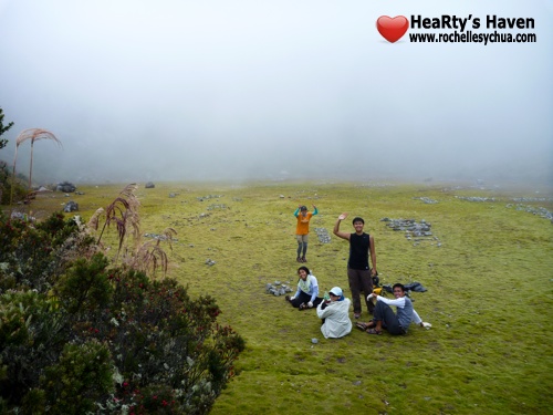
PSA and friends.
The core group is composed of dynamic individuals who share a passion for sports and the outdoors. I have been with them through a few trails where I saw their prowess, and they do not abandon nor look down upon stragglers such as I was. Recently their lady president conquered Mt. Kilimanjaro and she shows no sign of stopping there. They do look like your everyday people but when they get together for a common goal they blend magnificently. You have to see them in action to understand just what I mean! Sign up on the Yahoo! Group now and add them on Facebook to be on the loop for their activities.
Come join the PSA for the 25th Kinabalu Climbathon on October 2011!
Kinabalu Climbathon, “the world’s toughest mountain raceâ€â€¦
Are you tough enough?
See you on the trails!
——–
Mt. Kinabalu, “A beautiful monster!†–Kian V.
6° 5′ 0″ N, 116° 33′ 0″ E
——————–
Nell is a friend I met during our Davao trip before. When he travels he likes activities off the beaten path and away from cities; adventuring through nature by running and hiking. He may not write much, but he hopes you’ll love his fitness articles too, only here in HeaRty’s Haven!